
Results
The results of the case study will be presented here as they become available. Please check as well the publications related to the case study.
Due to its strategic importance and fertile soil, it has been settled partly densely through most of the time since the Early Neolithic, with settlements, grave fields, hill-forts and monumental ring ditches spanning from the Neolithic to modern times.
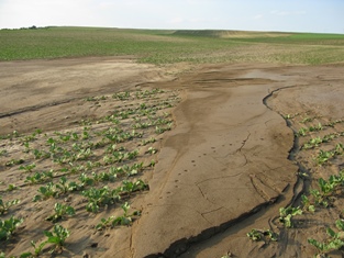
Among other key investigations concerning geoarchaeology, geology and field walking, recent studies were carried out to investigate erosion and accumulation processes in specific areas. This could be done by combining different datasets for closer integrated interpretation. It is obvious that once a feature is detected, especially using geophysical prospection techniques, it has to be seen as real. On the other hand, having no evidence might mean that an archaeological site has simply been covered due to accumulation processes. Even a single event can cause transportation of an enormous amount of material, as documented after a thunderstorm in May 2011 in the area. Therefore, erosion and accumulation have been and still are transforming the archaeological landscape.
In applying large-scale geophysical prospection using motorised magnetometers, one gets a larger overview of a specific area. In 2011, the LBI Archpro began continuous measurements, thus far covering an area of about 2.3 km2. In combination with other datasets, it was possible to investigate erosion and accumulation processes in greater detail.
|
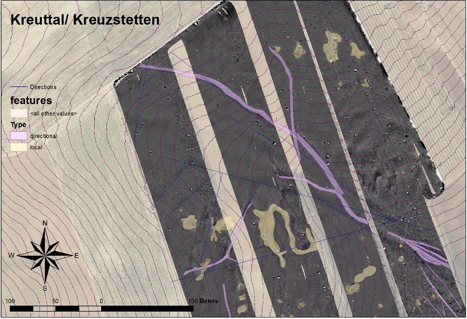
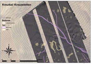
Firstly, palaeochannels and erosion lines detected by geophysical prospection or aerial archaeology might get a closer interpretation by visualising their location together with height lines. The surface of a landscape is under constant transformation, and might change in such a way that main erosion lines are modified through time. It can be argued that palaeochannels that still appear to be situated in a rill are younger than others that are not. Therefore, spatio-temporal information of the features observed within one method can be extracted in combination with another dataset. In the same way, geological structures in general are easier to interpret.
Secondly, it was observed that features documented on the basis of aerials from the 1980s were only partly visible within the recent datasets from geomagnetic surveys. Additionally, these features were documented on recent aerials as well, whereas the old features seem to be gone. The location of these features, which belong to a presumably Iron Age settlement, along a slope within the surrounding erosion lines might indicate the destruction of some features within 30 years due to erosion. Field walking and geoarchaeological surveying will allow a more detailed analysis of the observed phenomenon.
x Close
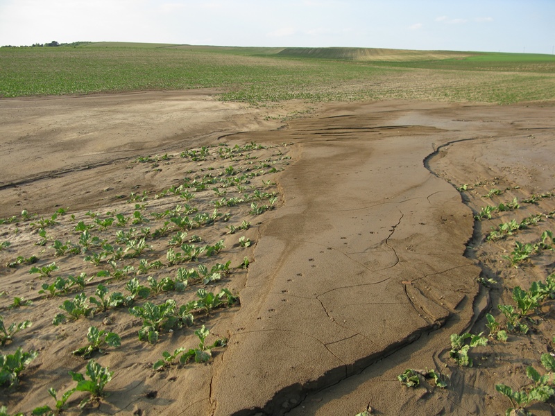
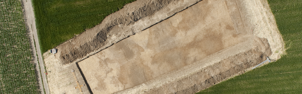
KreuttalErosion surface in an agricultural field in the Kreuttal, created by a single thunderstorm in May 2011. Erosion surface. Click to enlarge. | |
Finally, unusually large erosion rills could be observed at the northern slope of a hill south of Kreuzstetten in the most northern part of the study area. From a geological point of view, this phenomenon seems to be outstanding in the region, although the geology slightly changes in this area. Historical analysis might show that in this case these erosion lines were initiated by extensive forest operation that transported wood from the wide plateau to the village of Kreuzstetten in medieval and modern times. These results underline the importance of an integrated interpretational approach for a closer understanding of the change of archaeological landscapes. Although a landscape seems to be quite static, it could be seen that this is not true even for shortterm observations. Fascinatingly enough, it is possible to get a more detailed understanding of recent erosion and accumulation processes as a by-product of the investigation of passed landscapes.