
Motivation
x Close
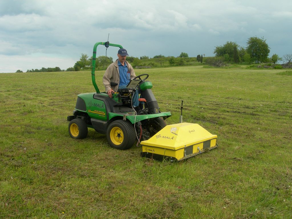
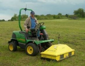
BirkaFirst high-resolution georadar prospection at Birka in 2008. MALÅ Geoscience's Head of Development Bernth Johansson operating the 16 channel MALÅ Imaging Radar Array. First motorized georadar survey in 2008. | Click to enlarge. |
The settlement Birka was founded in the 8th century AD as an important Viking age trading place. First high-resolution geophysical archaeological prospection surveys conducted at Birka in the years 2006 and 2008 have demonstrated a great potential for the generation of valuable new archaeological knowledge. The Birka Case study is conducted in collaboration with the LBI ArchPro Partner organization RAÄ (Swedish National Heritage Board) and RAÄ - UV Teknik.
While in 2008 it still appeared impossible to map the entire archaeological site of Birka-Hovgården, the setup of the LBI ArchPro with its research focus on large-scale landscape archaeological prospection has made it possible to develop, test and demonstrate latest high-resolution prospection technology and methodology at this extraordinary site, which is home to one of the best preserved Scandinavian Viking Age settlements and burial places.
The goal of this case study is to map all accessible areas on Björkö as well as at Hovgården using non-invasive high-resolution geophysical prospection (magnetometry and ground penetrating radar) as well as airborne remote sensing methods in order to investigate the method's potential to analyse and understand the structure and development of this important Viking Age site, while simultaneously advancing both prospection technology and methodology.
Of interest at the UNESCO World Cultural Heritage Site Birka-Hovgården is the postglacial landrise, which has led to a lowering of the shoreline of Lake Mälaren by approximately 5 m since the year 800 AD, and Viking Age harbour constructions now to be found on land.
The case study Birka-Hovgården is one of several case studies of the LBI ArchPro, such as the Stonehenge Hidden Landscape Project (UK), mapping of the Iron Age settlement of Uppåkra, or the blanket coverage of the entire Roman town of Carnuntum in Austria. Researchers within the LBI ArchPro have gathered considerable experience in regard to Scandinavian Iron Age sites by having conducted large-scale archaeological prospection surveys at the comparable sites of Kaupang, Borre, Gokstad, and Odberg in Norway and Hedeby in Germany.
The work is conducted in close collaboration with local experts on the site as well as on aspects of cultural hertiage management, involving archaeologists from the Swedish National Heritage Board and the National Historical Museum as well as experts on public communication of the results. The high-resolution prospection data as well as its integrative archaeological interpretation will contribute to the investigation and preservation of this fascinating and unique World Cultural Heritage Site, providing new insights and stimulus for further research.