


Results
A host of previously unknown archaeological monuments have been discovered around Stonehenge as part of an unprecedented digital mapping project that will transform our knowledge of this iconic landscape - including remarkable new findings on the world's largest 'super henge', Durrington Walls.
Discovery of massive, Late Neolithic pit structure near Stonehenge
Recent fieldwork and analysis have revealed evidence for 20 or more massive, prehistoric shafts, measuring more than 10 metres in diameter and 5 metres deep. These shafts form a circle more than 2 kilometres in diameter and enclose an area greater than 3 square kilometres around the Durrington Walls henge, one of Britain’s largest henge monuments, and the famous, smaller prehistoric circle at Woodhenge.
Remains of major new prehistoric stone monument at Durrington Walls discovered
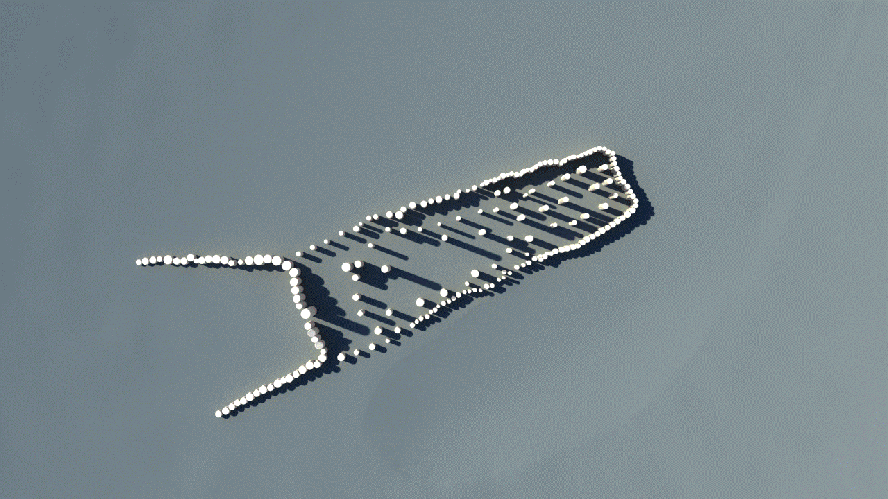
The remains of a major new prehistoric stone monument have been discovered less than 3 kilometres from Stonehenge. Using cutting edge, multi-sensor technologies the Stonehenge Hidden Landscapes Project has revealed evidence for a large stone monument hidden beneath the bank of the later Durrington Walls 'super-henge'.
x Close
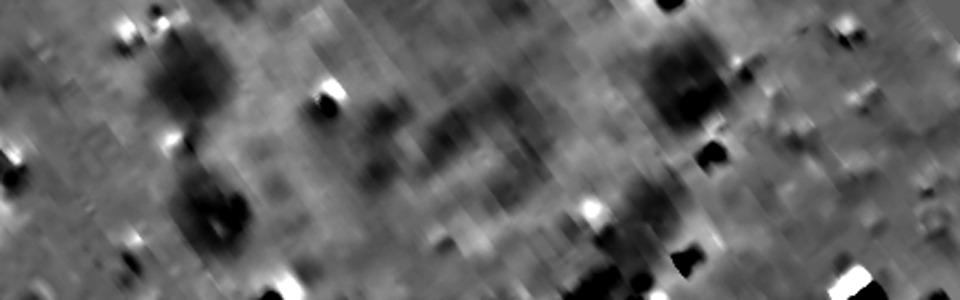
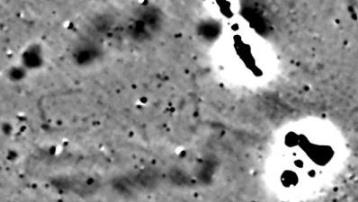
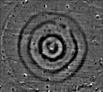
Magnetic data imageand interpretation of the long barrow and adjacent trenchesMagnetic data image of the long barrow. Click to enlarge. | |
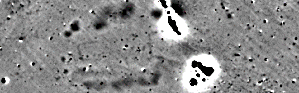
Remote sensing techniques and geophysical surveys have discovered hundreds of new features which now form part of the most detailed archaeological digital map of the Stonehenge landscape ever produced. The startling results of the survey include 17 previously unknown ritual monuments dating to the period when Stonehenge achieved its iconic shape. Dozens of burial mounds have been mapped in minute detail, including a long barrow (a burial mound dating to before Stonehenge) which revealed a massive timber building, probably used for the ritual inhumation of the dead following a complicated sequence of exposure and excarnation (defleshing), and which was finally covered by an earthen mound.
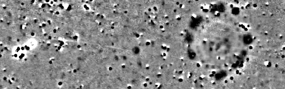
Work also revealed novel types of monument including massive prehistoric pits, some of which appear to form astronomic alignments, plus new information on hundreds of burial mounds, Bronze Age, Iron Age and Roman settlements and fields at a level of detail never previously seen. Taken together, these results - which will be featured in a major new BBC Two series titled Operation Stonehenge: What Lies Beneath - show that new technology is reshaping how archaeologists understand the landscape of Stonehenge and its development over a period of more than 11,000 years.
x Close
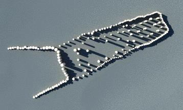
Virtual reconstruction suggestionof the long barrow based on the prospection resultsReconstruction suggestion of the long barrow. Click to enlarge. | |
In the year marking the centenary of the First World War, the new Stonehenge map even impacts on our knowledge of that momentous event. Surveys have produced detailed maps of the practice trenches dug around Stonehenge to prepare troops for battle on the western front, as well as maps of RAF/RFC Stonehenge - one of Britain's first military airbases used by the Royal Flying Corps between 1917 and 1920.
British project leader Professor Vincent Gaffney, Chair in Landscape Archaeology and Geomatics at the University of Birmingham, said: 'The Stonehenge Hidden Landscapes Project is unique at a global level. Not only has it revolutionised how archaeologists use new technologies to interpret the past, it has transformed how we understand Stonehenge and its landscape. Despite Stonehenge being the most iconic of all prehistoric monuments and occupying one of the richest archaeological landscapes in the world, much of this landscape in effect remains terra incognita. This project has revealed that the area around Stonehenge is teeming with previously unseen archaeology and that the application of new technology can transform how archaeologists and the wider public understand one of the best-studied landscapes on Earth. New monuments have been revealed, as well as new types of monument that have previously never been seen by archaeologists. All of this information has been placed within a single digital map, which will guide how Stonehenge and its landscape are studied in the future.'
x Close
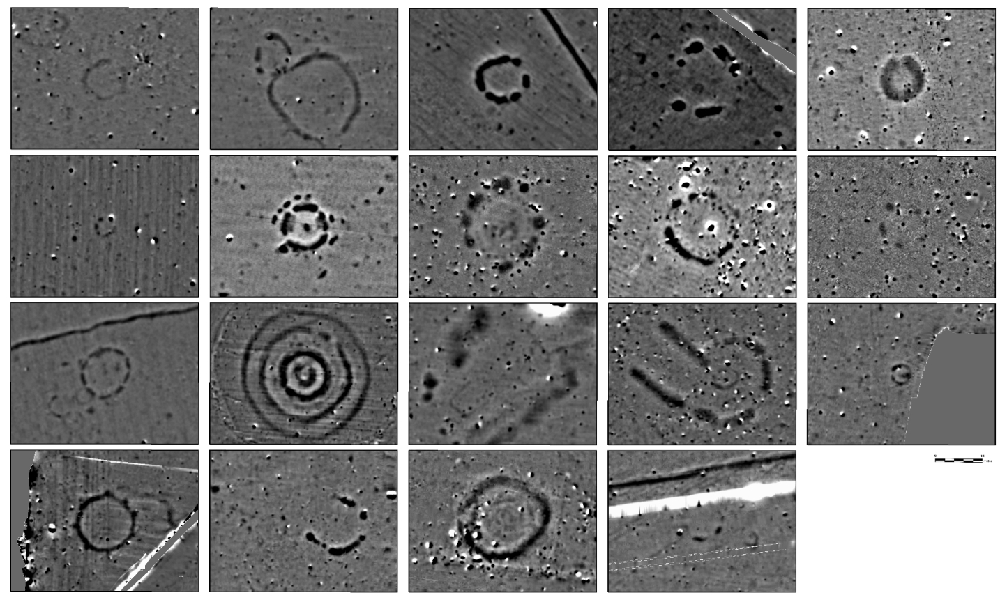
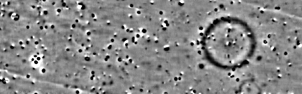
Magnetograms of the monumentshidden in the Stonehenge landscape(width of scale bar: 15 m) Newly mapped monuments at Stonehenge. Click to enlarge. | |
Professor Wolfgang Neubauer, Director of the Ludwig Boltzmann Institute, said: 'Developing non-invasive methods to document our cultural heritage is one of the greatest challenges of our time and can only be accomplished by adapting the latest technology such as ground-penetrating radar arrays and high-resolution magnetometers. The developments of the Ludwig Boltzmann Institute for Archaeological Prospection and Virtual Archaeology offer Europe the opportunity to carry out fundamental archaeological research at a scale and precision never previously attempted.'
'No landscape deserves to benefit from a study at this level of detail more than Stonehenge. The terabytes of digital survey data collected, processed and visualised by LBI ArchPro provide the base for the precise mapping of the monuments and archaeological features buried in the subsurface or still visible in the landscape surrounding Stonehenge. After centuries of research, the analysis of all mapped features makes it possible, for the first time, to reconstruct the development of Stonehenge and its landscape through time.'
Dr Nick Snashall, National Trust Archaeologist for the Avebury and Stonehenge World Heritage Site, said: 'Using 21st-century techniques, the Stonehenge Hidden Landscapes team have transformed our knowledge of this ancient, precious and very special landscape. Their work has revealed a clutch of previously unsuspected sites and monuments showing how much of the story of this world-famous archaeological treasure house remains to be told.'
Dr Heather Sebire of English Heritage, Curator of Stonehenge, said: 'This is such an exciting project. The surveys will help us form an understanding of possible new sites which have not been recorded before but which will need further investigation.' Operation Stonehenge: What Lies Beneath is due to be broadcast on BBC Two at 8pm BST on Thursday 11 September. The documentary will also be broadcast in the US (Smithsonian Channel), Canada (CBC), Austria (ORF), Germany (ZDF) and France (France 5).