


Scientific Research Project "ArchPro Carnuntum"
Archaeological Prospection of a Roman Landscape
The goal of the ArchPro Carnuntum Project was to develop a basis for sustainable, knowledge-based management of the archaeological landscape of Carnuntum by using a systematic and large-scale approach with non-destructive and non-invasive archaeological methods.
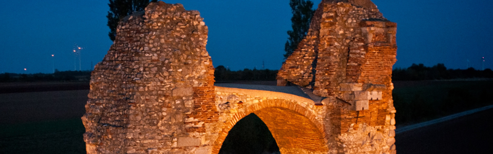
Within the framework of the ArchPro Carnuntum Project, running from 2012-2015, and under the direction of LBI ArchPro, the Roman city of Carnuntum was completely surveyed. This project is unique due to its modern research approach and the large dimensions of the area that was surveyed. It was financed with the support from the county of Lower Austria and has been implemented by an international partner network. In cooperation with the partner organizations ZAMG (Central Institute for Meteorology and Geodynamics) and the University of Vienna, the LBI ArchPro has developed efficient multi-sensor systems and suitable data acquisition and data processing software for a large-scale archaeological prospection of Carnuntum.
For the survey of area of the ancient city, large-scale geophysical prospection measurements were conducted with state-of-the-art technology and in cooperation with ZAMG Archeo Prospections® (Austria), University of Ghent (Belgium), and Geocarta (France). Motorized geophysical systems, which had already been developed, were adapted for the special needs of archaeological prospection at Carnuntum. With these updated systems, an efficient, large-scale survey with cross-line spacing in the decimeter range was possible and in combination with instruments capable of the highest measuring accuracy the exploration of archaeological structures, even within the range of 10 to 50 cm, was successful.
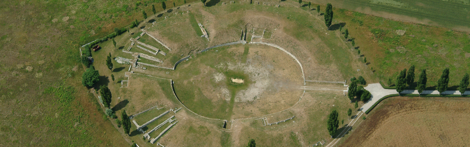
For the systematic archaeological prospection of the Roman city, the geomagnetic prospection was planned based on the results from aerial surveys. The central city area was also covered by high-resolution, ground-penetrating radar measurements in order to further intensify the overview created by aerial archeology and magnetics. The ground-penetrating radar allows for a three-dimensional visualization of structures hidden in the ground, due to the use of electromagnetic waves. In selected areas, supplementary measurements were carried out using electrical and electromagnetic methods.
The ArchPro Carnuntum research project also has an international impact. The exact knowledge of the archaeological heritage in the subsoil is of great importance not only for the research and the preservation of monuments around the world, but also for general urban and regional planning. In this sense, economic development in the Carnuntum region has also benefited from this project.
The project results deliver a comprehensive inventory of the largest archaeological landscape in Austria and also provide a basis for spatial planning and ground conservation. The direct result is a complete map of the remains of Roman Carnuntum not only as a basis for virtual reconstructions and future archaeological research, but also as an example for planning sustainable cultural heritage management, economic development and public relations.
This online publication is intended to present the background and preliminary results of an internationally unique prospection project with an exemplary character.