


Non-invasive discovery and investigation of archaeological landscapes
The use of non-destructive prospection methods, from the air and on the ground, before any archaeological excavation is a requirement of the Valletta Convention of the European Union for the protection and preservation of archaeological heritage (Council of Europe 1992).
In the past, extensive archeological excavations were undertaken to reconstruct the overall plan of the Roman city and to explore the archaeological landscape of Carnuntum. Modern archeology is using non-invasive methods of archaeological prospection for the discovery and mapping of archaeological remains. Out of several different prospection methods, remote sensing and geophysical prospection have proven to be particularly suitable for the mapping and detailed documentation of Roman cities.
Compared to traditional methods of archaeological excavation, these techniques provide an extremely cost-effective way to gain fast and detailed information about the subsurface.
Remote sensing
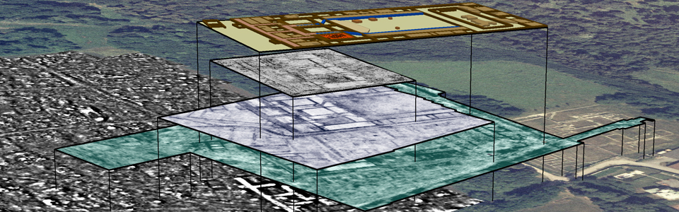
Aerial archeology is based on vertical and oblique photos taken from an aircraft that are then photogrammetrically and archaeologically interpreted. Today's modern remote sensing techniques provide advanced and efficient possibilities for high-resolution discovery, exploration and documentation of the archaeological heritage in areas with entire archaeological landscapes. To date, more than 7,800 archaeological features have been mapped, covering an area of 11 km2 throughout Carnuntum and its surroundings.
Other remote sensing techniques and methods are also available for the high-resolution exploration and documentation of the archaeological landscape of Carnuntum, these include airborne laser scanning (ALS), using Full-Waveform-Scanner, and hyperspectral scanning (also called airborne imaging spectroscopy (AIS)). These methods of archaeological remote sensing, which were used extensively by the LBI ArchPro partner Airborne Technologies, were able to provide important information on archaeological topics, such as settlement patterns, environmental features and the general landscape, and has also contributed to further discoveries. Within the framework of the LBI ArchPro research program, ALS and AIS surveys and their archaeological evaluation were carried out in close cooperation with the County of Lower Austria and form an essential foundation for integrated geophysical prospection.
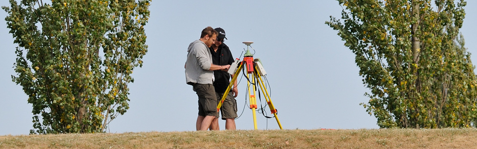
Geophysical archaeological prospection
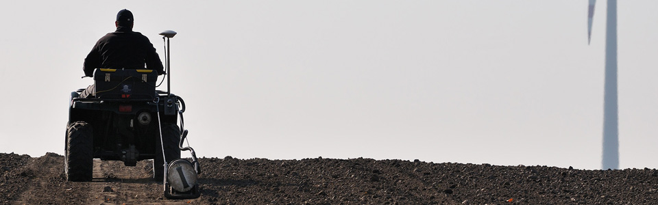
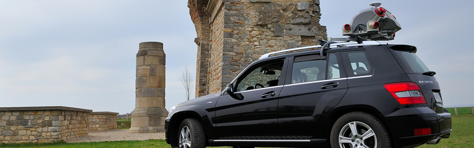
On the ground, several complementary methods of geophysical prospection are used to compress information obtained from the air. Geophysical prospection is based on the measurement of the slightest contrasts in the physical properties of the archaeological structures with their surrounding soil material. Archaeological prospection of Roman city areas has proved particularly suitable for magnetics, electrical resistance measurement, ground-penetrating radar and special electromagnetic methods.
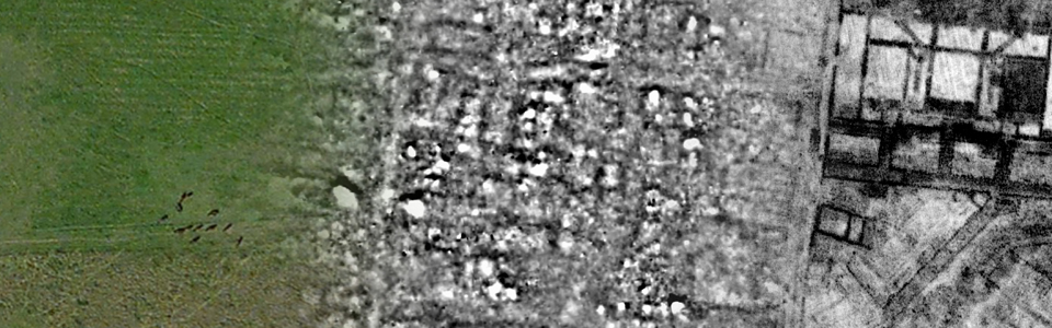
The most effective methods of geophysical prospection for archaeological applications are magnetic and ground-penetrating radar measurements. The geodetically accurately measured magnetic and radar images are archaeologically interpreted in a geographic information system (GIS) together with all additional information, therefore allowing for comprehensive maps of the remains of the past hidden in the ground. Together, these interpretations form the basis for the Roman landscape of Carnuntum, which is made visible again after 1,500 years.
Magnetic archaeological prospection is based on the high-resolution measurement of minor deviations in the earth's magnetic field. These deviations, or anomalies, are due to the change in the magnetic properties of the upper surface by the use of fire in the past as well as the filling of pits, posts and trenches with magnetically enriched material. Additionally, fireplaces, iron smelting sites, and brick and limestone walls all cause anomalies and can be mapped under appropriate circumstances.
The ground-penetrating radar method basically functions like an echo sounder for use on land: a transmitter antenna sends a short electromagnetic signal into the ground and is reflected by layer boundaries or objects, such as buried bricks, and recorded by a receiver antenna. The results of ground-penetrating radar measurements are the recording of digital three-dimensional data blocks, which create horizontal slices of the changes of the soil and any contained archaeological structures in its respective depth.