
Results
|
The results of the case study will be presented here as they become available. Please check as well the publications related to the case study.
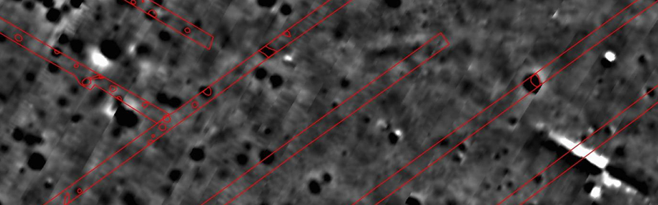
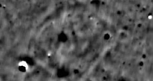
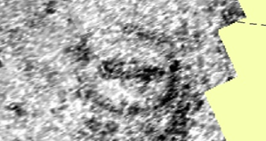
The magnetic data image shown above has been recorded in 2011. The black blotches indicated prehistoric pits and postholes in the subsurface.
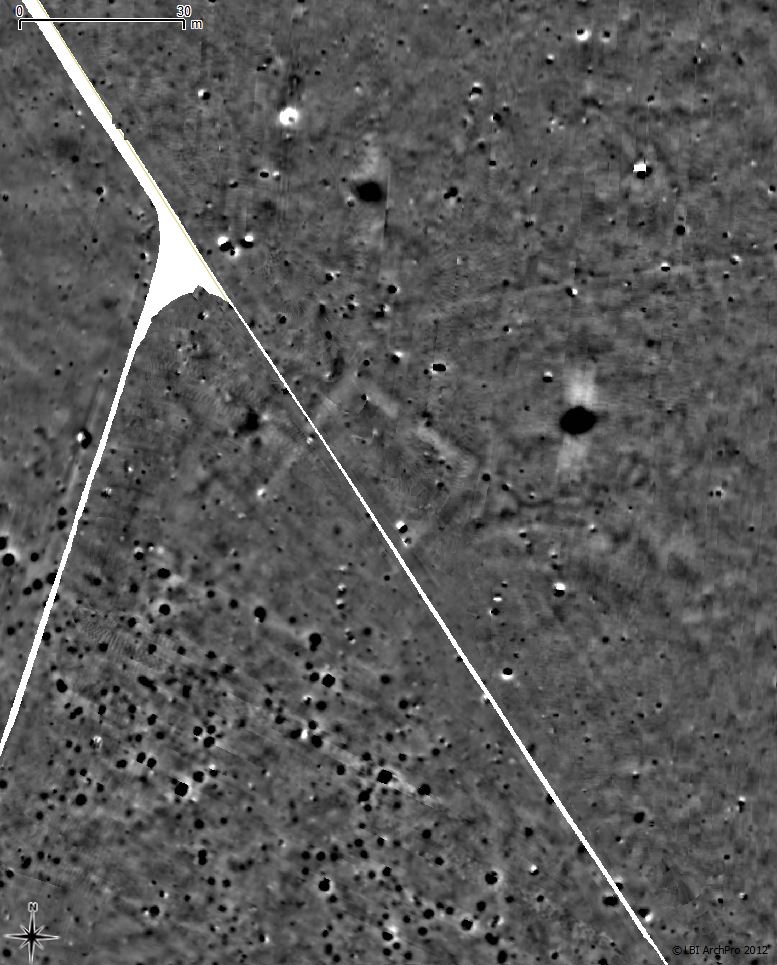
The red lines mark trenches of an excavation conducted in the year 2000. Excavated structures of archaeological interest have been marked by red polygons. Very good agreement between the excavated archaeological structures and the magnetic anomalies can be seen.
Results of the large-scale magnetometer surveys
The magnetometer surveys covered in total 1.97 square kilometres, the largest so far in Sweden with magnetic prospection methods archaeologically investigated interconnected area. Numerous anomalies caused by buried archaeological structures in the subsurface have been discovered, providing valuable new information about the settlement and its surrounding landscape.
|
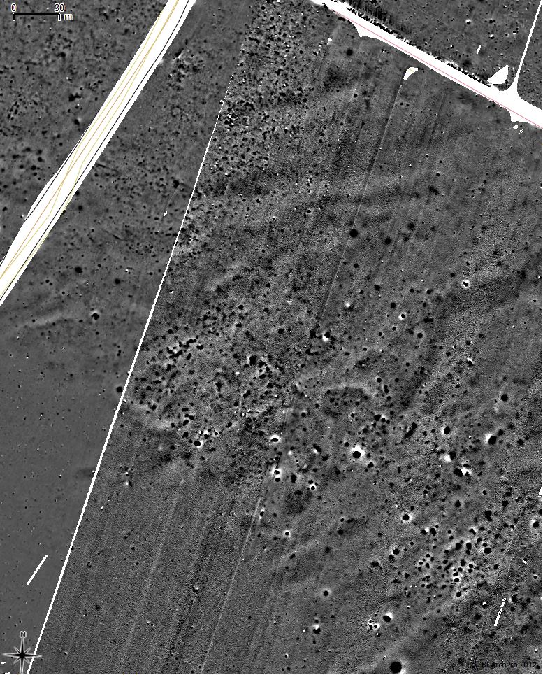
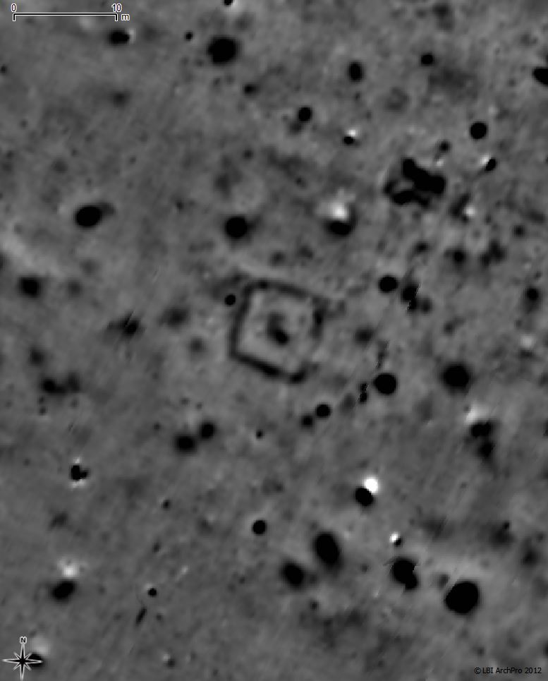
Some 500 m south of Uppåkra church a large number of anthropogenic structures has been mapped by magnetic prospection. These are caused by pits, postholes and hearths. The structures differ in their size and appearance from the structures visible in the more central part of Uppåkra site. Furthermore, the dense find distribution mapped by metal detector survey does not extend into this field. The structures are sharply bounded to the south, where a former wetland is likely to have been (today an open drainage channel, as well as drainage systems visible in the magnetic data suggest that the area has been more humid in the past). It would be of great interest to determine whether these structures are contemporary with the Uppåkra site (Iron Age) or even older (Bronze Age, Neolithic).
|
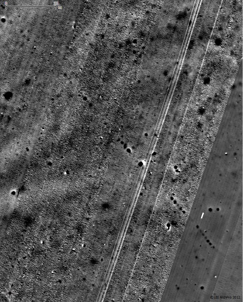
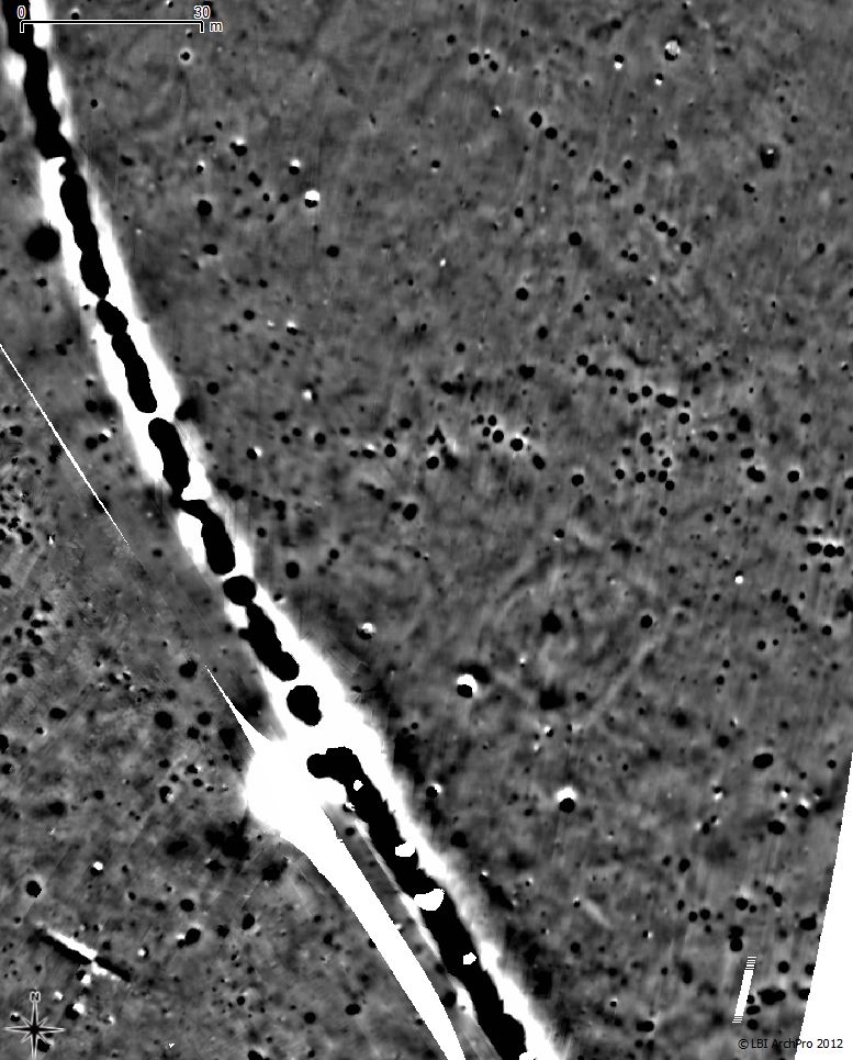
Two distinct pit alignments have been detected by magnetic prospection south-east of the main settlement area. Similar pit alignments have been discovered by magnetic prospection in Gamla Uppsala, where excavation had shown that the large pits with circa 5 m spacing contained large stones, supporting lagre wooden posts. Furthermore the pit alignment in Gamla Uppsala appears to have been flanked by hearths with greater inter-spacing. The determination of the age, exact construction and function of the pit alignments in Uppåkra would be an interesting future research question.
|
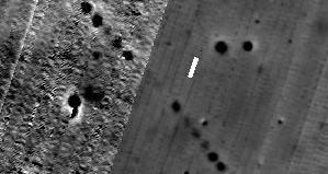
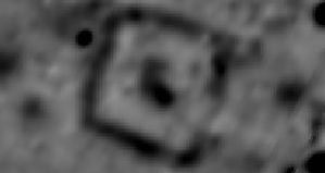
A rectangular structure of 28 m side length has been detected on the ridge south-east of Uppåkra church, with a clear opening in its north eastern side. Should this structure not be related to Torstenson's army camp in 1644, e.g. a small redoubt or fortified area within an army camp, but be contemporary with Iron Age Uppåkra, then this would be a very remarkable structure. Prehistoric finds have been made in the vicinity. The SW side of the rectangular structure was cut by the 2000 excavation and its wall was marked as archaeological structure. However, it is likely that the true nature of this find may not have been understood due to the limited trench. The negative magnetic anomaly indicates that we are having foundation/remains of stone walls in the subsurface.
|
A second rectangular structure, size circa 26 by 24 m, most likely surrounded by stone wall, was found SE of the first rectangular structure. Note that both rectangular structures have the same orientation, and that in the second case even another pit alignment 50 m to the north of the rectangular structure has the same orientation. The strong banded anomaly is a modern utility.
In the main settlement area it was possible to clearly delimit the settlement to the northwest and west. Numerous Iron Age buildings are visible. Towards the east the possible overlap between the Iron Age settlement and a possible army camp from Torstensons's war (1643/44) complicates the interpretation of the in very large numbers occuring pits/postholes.
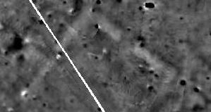
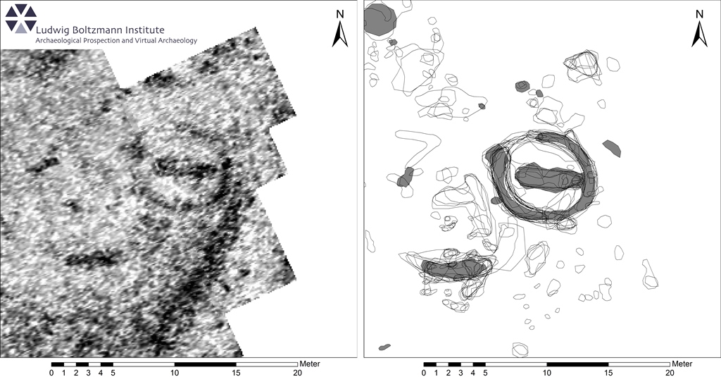
An interesting structure was discovered in 2011, which clearly can be interpreted as a grave/burial pit surrounded by a quadratic trench with an opening to the east. The archaeological interpretation of the large amount of magnetic prospection data is work in progress, which will be published in due course.
|
Results of the high-resolution GPR prospection
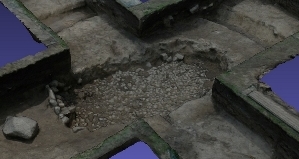
The high-resolution GPR survey of the central settlement area resulted in the discovery and mapping of a large number of building structures, which have been and are being interpreted. The discovery of a circular structure of ca. 9 m diameter under the lawn west of Uppåkra church yard with a central east-west oriented stone packing led to the archaeological excavation of a rare Neolithic grave. The GPR prospection results have been confirmed in great detail by the subsequent excavation. This excavation has been documented in detail in 3D by staff and students from the University of Lund.
x Close
UppåkraCircular grave with central burial. GPR data and interpretation. Circular grave. Click to enlarge. | |
x Close

Uppåkra3D documentation of the excavation results. Source: http://www.uppakra.se/gravdagbok/dokumentation-i-3d/ 3D documentation of the excavation results. Click to enlarge. | |