


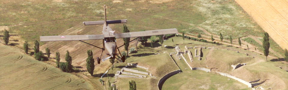
Systematic aerial survey
Aerial photography
Aerial archaeology is one of the oldest archaeological prospection methods and is used to non-invasively detect and investigate archaeological sites. Since the 1960s, it has been developed and employed by the University of Vienna in Austria.
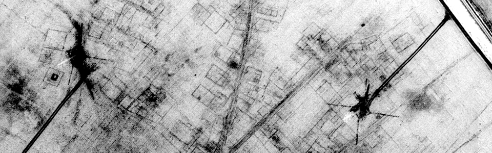
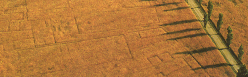
Archaeological sites can often be detected from the air due to some human activities that have left traces in the ground, such as the construction of houses, the burial of the dead or the tracks of ancient pathways. These traces can be seen under certain conditions on the surface of the earth through their various effects on the growth of plants. For example, above trenches or pits filled with finer and humid material, plants have a greater moisture and nutrient reserve, grow higher, have a more intense green color and mature later. The opposite occurs with soil above walls or paths. In these cases, the root is often too dry due to a thin humus blanket, therefore, the plants have a reduced growth cycle, ripening early and dwindling rapidly. Such characteristics can be well-observed from the air.
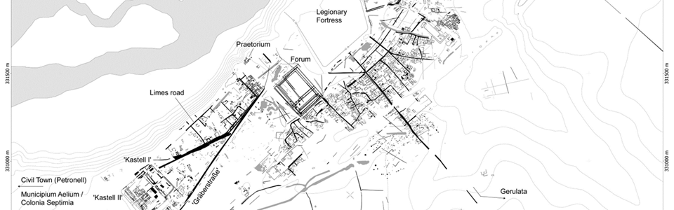
Carnuntum has been part of aerial archaeological research for a long time, a result of which has now led to an overall plan of the civilian town and the so-called canabae legionis around the legionary camp and its surroundings. In recent years, parts of the Carnuntum hinterland have also been systematically prospected, resulting today in the knowledge of more than 1400 sites in this area.
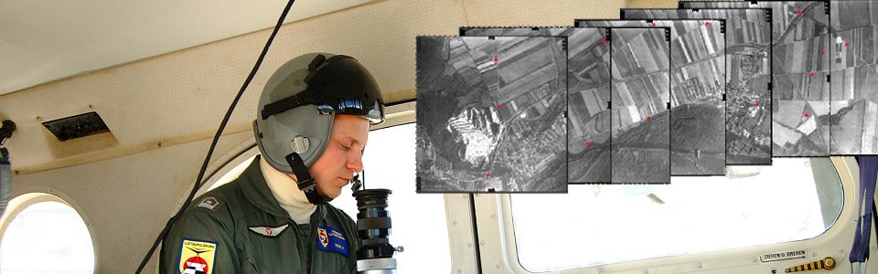
The evaluation of the numerous aerial photographs is carried out using the latest technologies. First of all, digital photogrammetric methods must be used to correct the geometrical distortions of the aerial images, which are caused by, among other things, the oblique camera angle, differences in height on the ground or the distortion of the camera lens. The archaeological interpretation of the rectified and ordered aerial photographs is then carried out in a geographic information system in the form of a map of the visible pits, ditches, walls, streets, grave pits, etc. and leads to a first overview plan of the Roman city zone and the surrounding area.