


Magnetic imaging of entire landscapes
Large-scale mapping with motorized magnetometer arrays
On the computer screen a magnetic image of the subsurface is created, showing anomalies caused by pits that have been filled with magnetically-enriched material, the remains of postholes, trenches, fireplaces and furnaces, floor heating systems, roads and trackways, as well as bricks and limestone walls.
The magnetic prospection method is well suited for generating detailed images showing archaeological structures hidden in the subsurface by means of conducting magnetic measurements on the ground. Using novel magnetometer arrays carried some 30 cm above the ground surface, minute variations in the Earth's magnetic field caused by buried archaeology are measured and detected. The observed anomalies are caused by differences between the magnetic properties of, for example, walls, floors, or road embankments relative to the surrounding soil. The infilled layers in prehistoric trenches and pits, which had been dug in Roman times, show distinct differences in their magnetic properties with respect to the surrounding material, and generally produce clearly recognizable magnetic anomalies. Numerous archaeological structures, such as ovens or hearths, brick constructions as well as the substructures of the typical Roman floor heating systems, can become particularly evident in magnetic prospection data due to the effect of thermo-remnant magnetization, which occurs when clay is burnt.
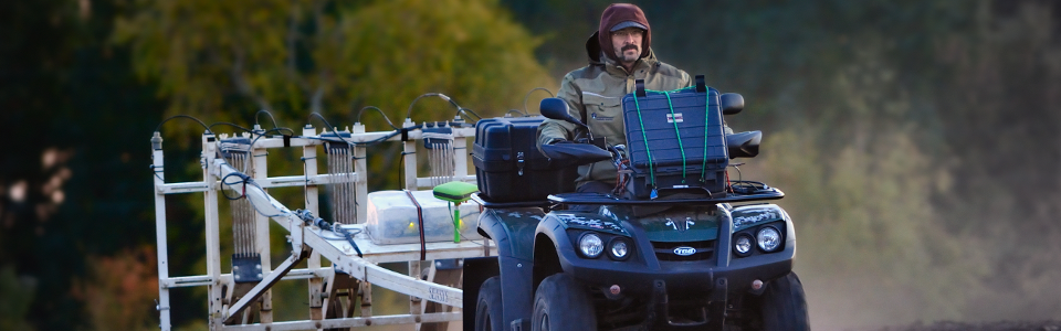
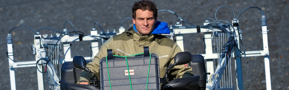
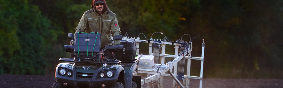
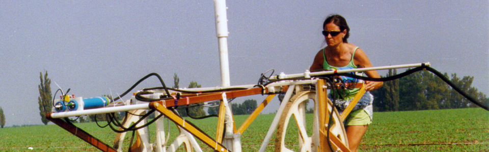
The magnetometer sensors are arranged on specially constructed non-magnetic instrument carriers in arrays of up to 10 sensors with 25 cm spacing between them. The sensor cart is towed behind a motorized quad at a distance of approximately 5 m, in order to minimize the disturbing magnetic influences caused by the tow-vehicle. At speeds of 20 to 40 km/hr, the magnetometer system is pulled across the survey areas, guided by specially developed navigation software. The vehicles used exert low ground pressure in order to minimize any adverse effects in the form of soil compaction or growth damage.