


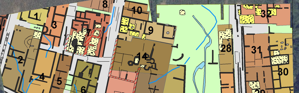
Integrative analysis of the prospection data
Virtual archaeology
The real archaeological landscape is transformed through the archaeological prospection into a virtual landscape that can be explored digitally by archaeologists using software tools. Thus, a virtual excavation is made possible without interfering with the ground, leaving the buried archaeology intact.
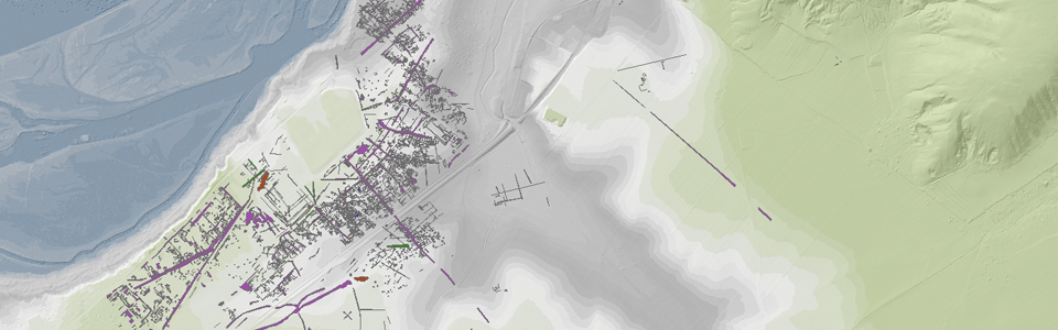
The analysis of the high-resolution data derived from the airborne and ground measurements is carried out with specially developed software tools, virtually exploring the digital data images or three-dimensional data volumes. The acquired digital data are combined with all other available information (digital terrain models, information derived from excavations, terrestrial laser scans, cadastral and geological maps) within adapted special software programs and are integrated in a Geographical Information System (GIS).
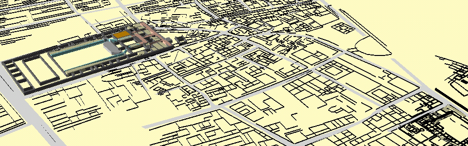
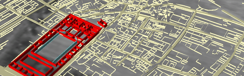
The archaeological interpretation of the prospection data takes place within the GIS. In short time, three-dimensional images of structures of archaeological interest can be generated and analyzed in relation to their surroundings as well as to already-known archaeological structures. The efficient, large-scale archaeological prospection approach developed and applied by the LBI ArchPro for the first time allows for the recognition and identification of new archaeological contexts across entire archaeological landscapes. Through this non-invasive approach, the exposed traces of prehistoric buildings, pits, ditches, post holes, transport and communications routes, graves and fortifications can tell of the structures, use and the historical development of the Roman town of Carnuntum.
The GIS forms the basis for the creation of specific maps and visualizations, serving as an information system on the Roman town of Carnuntum. It ensures the long-term availability of the data for sustainable cultural heritage management and spatial planning. On the basis of the newly-generated maps, plans and three-dimensional interpretation models, it is possible to create digital reconstructions, which revive for visitors the Roman landscape in virtual space, by using, for example, the Wikitude World Browser.
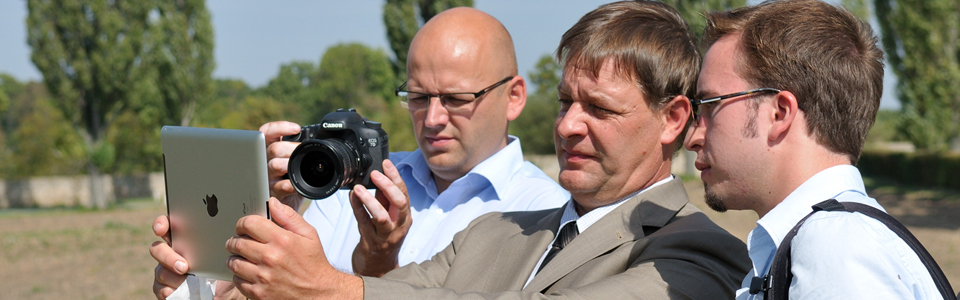
The Wikitude World Browser is a mobile application that embeds site-specific content into the camera image of a smartphone or tablet PC. This technology is called Augmented Reality. The "reality", as seen through the camera, is augmented by computer-generated content. Through Augmented Reality, the created three-dimensional models of the Roman buildings, such as, for instance, the school of gladiators, can be visualized directly at the site of the discovery. For the visitors of the Archaeological Park Carnuntum, this technology offers completely new possibilities to experience the local history and archaeological sites. By means of modern tools such as tablet computers, a journey through time becomes possible, permitting the visitors to stroll through the Roman city of Carnuntum.